Вы просматриваете архив за "February, 2015"
getTimeSeries: option “withLatsLons”
Add latitude and longitude coordinate to each date (line of the data frame) for the extracted time series.
> library(RWikience) > w<-WikienceConnect() Lookup : //localhost:8001/CWikienceRMIServer RMI object found > queryTimeSeries(w, "MERRA.Precipitation.Total", "01 01 1979", "01 08 2014", 12.0, -54.0, 12.0,-56.0 ) > getTimeSeriesPointsLatsLons(w) lat lon 1 12 -56.00000 2 12 -55.33334 3 12 -54.66667 4 12 -54.00000 > getTimeSeriesPointCount(w) [1] 4 |
Without “withLatsLons”
> t <- getTimeSeries(w, 0) > head(t, T) date value 1 1979-01-01 2.231096e-06 |
With “withLatsLons”
> t <- getTimeSeries(w, 0, withLatsLons = TRUE) > head(t, T) date value lat lon 1 1979-01-01 2.231096e-06 12 -56 |
Code used on this page:


AIR-Q-GOV
Averin G.V., Rodriges Zalipynis R.A., Pollutant Emissions Inventory and Air Quality Monitoring in Ukraine – AIR-Q-GOV Report Supplement: MWH SA, La Hulpe, Belgium, 2012. – 38 pp.
PDF ~ 300 KB
Full report at www.airgovernance.eu
PDF ~ 300 KB
Full report at www.airgovernance.eu
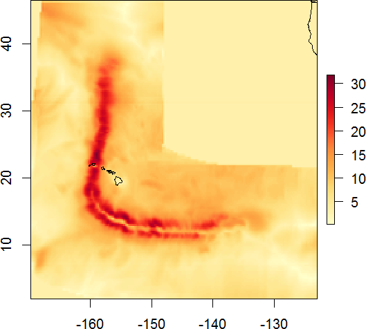
Hurricane Iniki
| Category 4 major hurricane (SSHWS/NWS) | |
| Formed | September 5, 1992 |
|---|---|
| Dissipated | September 13, 1992 |
| Fatalities | 6 direct |
| Damage | $1.8 billion (1992 USD) |
| Areas affected | Hawaiʻi (particularly Kauaʻi) |
| Part of the 1992 Pacific hurricane season | |
Open GeoTIFF in Quantum GIS
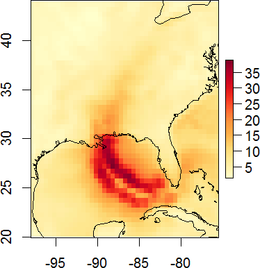
This video tutorial shows how to open a GeoTIFF file in Quantum GIS. Below is a screenshot of Quantum GIS with imported GeoTIFF for hurricane Katrina wind speed swath and OpenStreetMap layer to better perceive the geographical context.
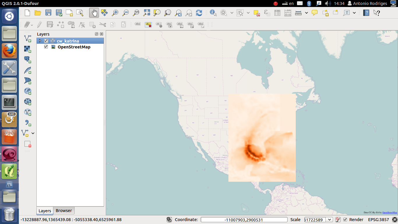
Video tutorial importing GeoTIFF to Quantum GIS:
note: the missing value for the GeoTIFF is set to -1 what explains the step in the tutorial where we set the additional missing value.
Feel free to post comments/questions.
Archives
- February 2022 (1)
- May 2015 (1)
- April 2015 (1)
- February 2015 (8)
- January 2015 (4)
- November 2014 (5)
- October 2014 (4)
- May 2014 (4)
Tags
- Air pollution (1)
- Air pollution risk (1)
- AMSR-E (2)
- Aura Satellite (1)
- CFSR (3)
- Cloud top pressure (1)
- Cloud top temperature (1)
- Greeness fraction (1)
- Hurricane Katrina (5)
- IBTrACS (1)
- isolines (4)
- LAI (1)
- MERRA (1)
- MODIS (2)
- Nitrogen dioxide (2)
- OMI (2)
- QuikSCAT (2)
- RWikience (1)
- SSMIs (2)
- Time series (2)
- TMI (2)
- Wind speed (2)