Video Tutorials
Open GeoTIFF in Quantum GIS
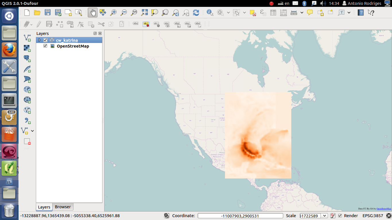
This video tutorial shows how to open a GeoTIFF file in Quantum GIS. Below is a screenshot of Quantum GIS with imported GeoTIFF for hurricane Katrina wind speed swath and OpenStreetMap layer to better perceive the geographical context.
Video tutorial importing GeoTIFF to Quantum GIS:
note: the missing value for the GeoTIFF is set to -1 what explains the step in the tutorial where we set the additional missing value.
Feel free to post comments/questions.


Introduction to Climate Wikience Interface
This video tutorial surveys basic capabilities of Climate Wikience interface: layers, time slider, introduces basic 3D visualization capabilities.Setting up color gradient
Adjusting the visualization of a variable on the 3D globe.RWikience: introduction
Introduction to RWikience: installing package to R, connecting to Climate Wikience, retrieving maps and time series.Archives
- February 2022 (1)
- May 2015 (1)
- April 2015 (1)
- February 2015 (8)
- January 2015 (4)
- November 2014 (5)
- October 2014 (4)
- May 2014 (4)
Tags
- Air pollution (1)
- Air pollution risk (1)
- AMSR-E (2)
- Aura Satellite (1)
- CFSR (3)
- Cloud top pressure (1)
- Cloud top temperature (1)
- Greeness fraction (1)
- Hurricane Katrina (5)
- IBTrACS (1)
- isolines (4)
- LAI (1)
- MERRA (1)
- MODIS (2)
- Nitrogen dioxide (2)
- OMI (2)
- QuikSCAT (2)
- RWikience (1)
- SSMIs (2)
- Time series (2)
- TMI (2)
- Wind speed (2)