Air quality (satellite data)
Climate Wikience contains a rich collection of air quality data derived from measurements of satellite instruments. Please refer to the table below.
| Component | Bias and units | Satellite (instrument) | Spatial resolution | Starting date | |
|---|---|---|---|---|---|
| Sulfur dixide (SO2) | 5 | DU | Aura (OMI) |
0,25° × 0,25° 27,5 × 18 km |
01.10.2004 |
| Nitrogen dioxide (NO2) | – | ||||
| Ozone (O3) | 6 | ||||
| Aerosol optical thickness, AOT (for 0,55 μm) | 15% | – | Terra (MODIS) |
1,0° × 1,0° 110 × 72 km |
02.03.2000 |
| Ozone (O3) | – | DU | |||
| Carbon oxide (CO) | 10% | DU | Terra (MOPITT) |
1,0° × 1,0° 110 × 72 km |
03.03.2000 |
| Carbon dioxide (СO2) | 2 | ppm | Aqua (AIRS) |
2,0° × 2,5° 220 × 144 km |
01.01.2004 |
The AOT value is unitless. Biases for satellite data are found experimentally. Bias defines the maximal deviation of the variable values from measurements observed by other instrumentation (ground stations, vertical atmopsheric sounding, aircraft, etc.). Dash (–) means that experiments for bias estimation are not finished.
Data are located at the nodes of regular latitude-longitude grid. The spatial resolution is approximately given for 48° latitude.
Temporal resolution of all data is one (1) day (i.e. data are available daily starting from the given date till current).
You can find examples of these data analysis in “Analysis” section of main menu. You can also browse all posts from analysis category.
|
|
|
|
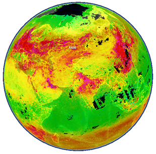
Nitrogen dioxide (NO2) |
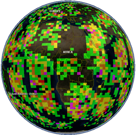
Carbon dioxide (СO2) |


Archives
- February 2022 (1)
- May 2015 (1)
- April 2015 (1)
- February 2015 (8)
- January 2015 (4)
- November 2014 (5)
- October 2014 (4)
- May 2014 (4)
Tags
- Air pollution (1)
- Air pollution risk (1)
- AMSR-E (2)
- Aura Satellite (1)
- CFSR (3)
- Cloud top pressure (1)
- Cloud top temperature (1)
- Greeness fraction (1)
- Hurricane Katrina (5)
- IBTrACS (1)
- isolines (4)
- LAI (1)
- MERRA (1)
- MODIS (2)
- Nitrogen dioxide (2)
- OMI (2)
- QuikSCAT (2)
- RWikience (1)
- SSMIs (2)
- Time series (2)
- TMI (2)
- Wind speed (2)