Region of interest allows you to select a geographical region to display data for. By default, Climate Wikience visualizes global data. If you select the region, only data for that region will be displayed (markers, surface and isolines).
By selecting a region you can accelerate the visualization performed by Climate Wikience since it requires to visualize much less data for much smaller area in contrast to global pictures.
The acceleration also takes place because ChronosServer needs to deliver much less data over the Internet to your PC running Climate Wikience.
The acceleration also takes place because ChronosServer needs to deliver much less data over the Internet to your PC running Climate Wikience.
Use “Select region” tool  located at the toolbar.
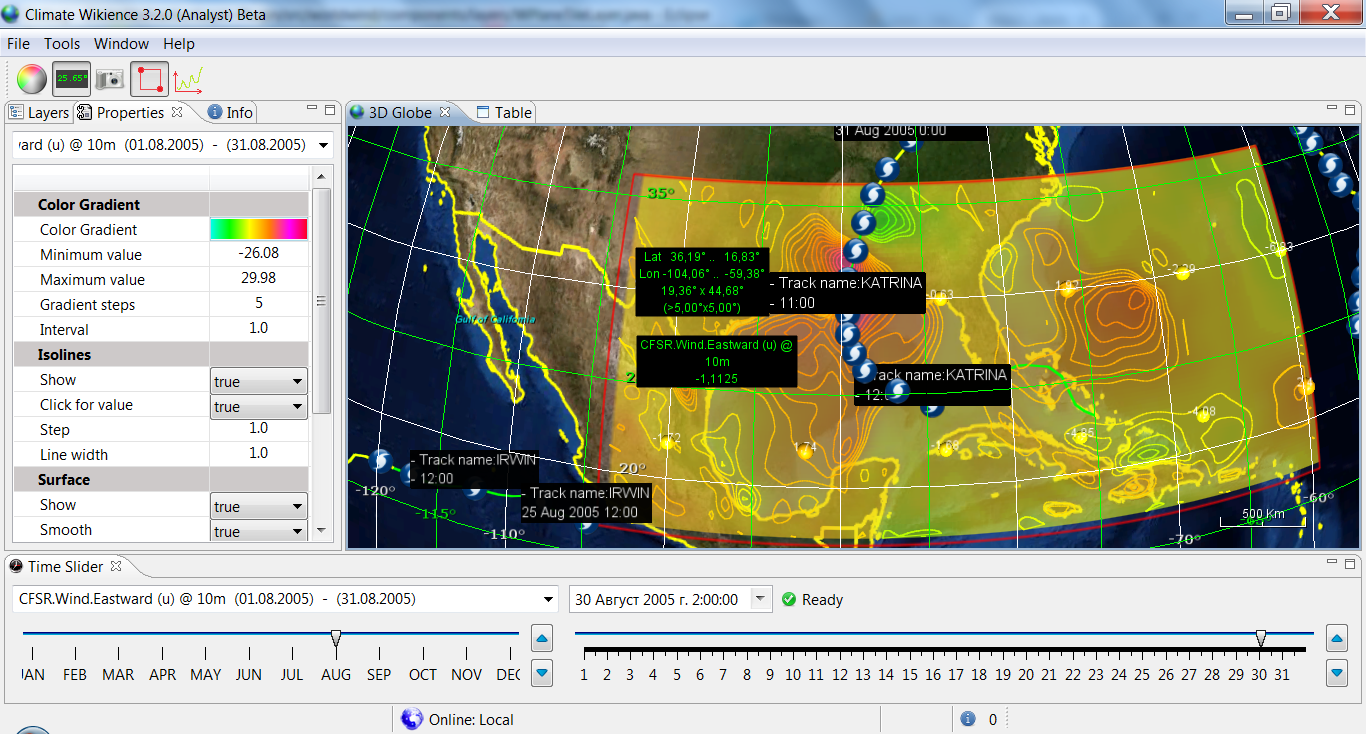
Eastward wind speed (u) at 10 meters above ground from CFSR during Hurricane Katrina(30 August, 2005).


Archives
- February 2022 (1)
- May 2015 (1)
- April 2015 (1)
- February 2015 (8)
- January 2015 (4)
- November 2014 (5)
- October 2014 (4)
- May 2014 (4)
Tags
- Air pollution (1)
- Air pollution risk (1)
- AMSR-E (2)
- Aura Satellite (1)
- CFSR (3)
- Cloud top pressure (1)
- Cloud top temperature (1)
- Greeness fraction (1)
- Hurricane Katrina (5)
- IBTrACS (1)
- isolines (4)
- LAI (1)
- MERRA (1)
- MODIS (2)
- Nitrogen dioxide (2)
- OMI (2)
- QuikSCAT (2)
- RWikience (1)
- SSMIs (2)
- Time series (2)
- TMI (2)
- Wind speed (2)